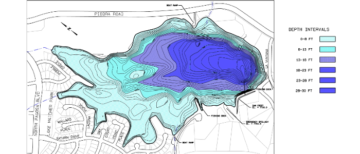
Riverbend Engineering completed bathymetric surveys of four lakes in the Pagosa Springs area for the local water utility authority. The surveys were completed using sonar depth measurements and simultaneous total station measurements of the survey boat’s location. Bathymetric mapping was developed from the survey point data and the resulting 3D ground surface model. Stage-Volume relationships were developed for each reservoir, and were used by the client to verify their storage capacity relative to their deeded water rights.
The 4 lakes are Hatcher Lake (fed by a diversion from Martinez Creek), Lake Pagosa (fed by a diversion from Stevens Creek), Village Lake (just downstream of Lake Pagosa), and Lake Forest (just downstream of Village Lake)–click on the lake names (above) for their topo maps.