 There are thousands of low head dams throughout the U.S. that were built to accomplish a specific purpose. Unfortunately many of these structures have created un-intended consequences, including barriers to fish migration, boater entrapment hydraulics and sediment traps. Diversions for irrigation or hydropower may serve a continuing need, and sometimes the old structure can be replaced with a diversion system that does not have the same adverse impacts. Riverbend Engineering has helped quite a few clients to rebuild or modify their low head dams in ways that no longer create fish or sediment barriers, and no longer create hydraulic death traps for boaters. We also understand the impacts of removing large dam structures, and what restoration looks like in 100-yr old reservoir sediment deposits.
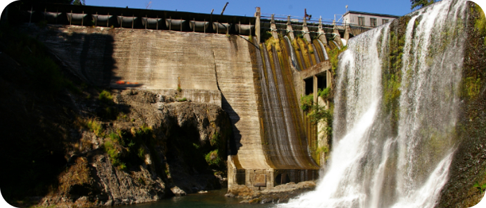
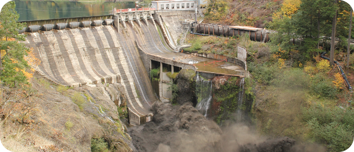
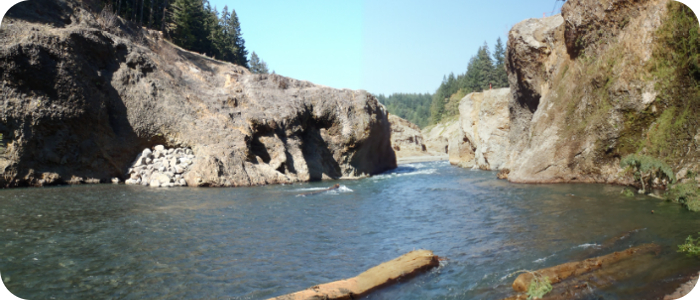
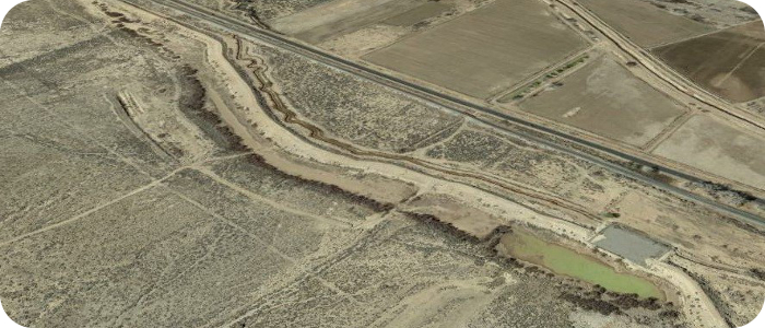
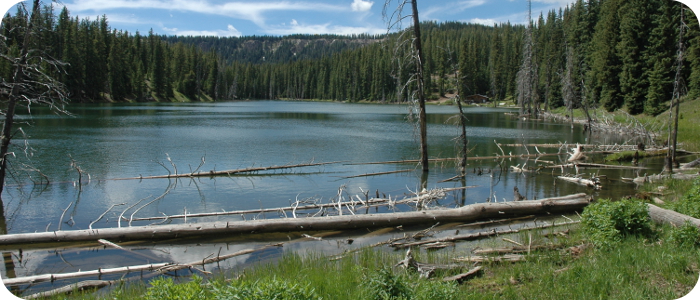
White Salmon River at Condit Dam, WA
 In south central Washington, ~ 3 river miles upstream from Columbia River confluence, near WA/ OR border Riverbend was hired (by J.R. Merit, Inc. Dam Removal General Contractor who was hired by PacifiCorp) to oversee the general contractor’s implementation of the environmental restoration aspects of this project. Riverbend was directly responsible for the evaluation and design of restoration features in the White Salmon River and its on-site tributaries, design of woody debris structures in the river, design of riparian area restoration, grading and stabilization of sediments left behind in the former reservoir. Riverbend’s subcontractors took care of all the water quality monitoring, and all the aerial photography and LiDAR mapping. Riverbend provided consulting engineering support for many other smaller tasks over the project’s duration, from designing a bypass water pipeline, to evaluating the stability of relic bridge structures in the river, exposed by the elimination of the reservoir. Condit Dam is the largest concrete dam to be removed in the US for environmental reasons. The dam removal was featured in Patagonia’s Dam Nation movie released spring 2014 (and edited from Ben Knight’s office in Telluride) Riverbend Engineering’s staff was on-site in full force for the for the epic explosive dam removal in October of 2012.
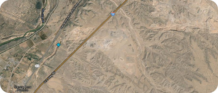
Santa Ana Dam on Algodones Ditch near Santa Ana Pueblo, NM
 Santa Ana Dam had been classified as a high hazard dam, under the USBR’s Safety of Dams (SOD) criteria. The dam breach analysis indicated that there would be significant property damage and a reasonable likelihood that loss of life might occur. This earth fill dam did not meet current criteria for seismic stability, and seepage was evident at the base of the dam whenever water collected in the upstream pool. The Pueblo of Santa Ana elected to take the least costly option: functionally breaching the dam by creating an armored notch in the embankment. Riverbend’s engineers analyzed the hydraulic capacity of the dam, the hydrologic response of the watershed, and the size of the breach notch that would be required to reduce the dame hazard classification. Riverbend’s engineers also performed the dam breach analysis, and developed the flood inundation mapping for the affected areas downstream.
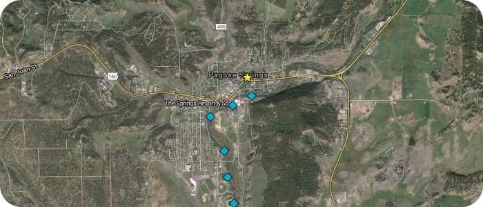
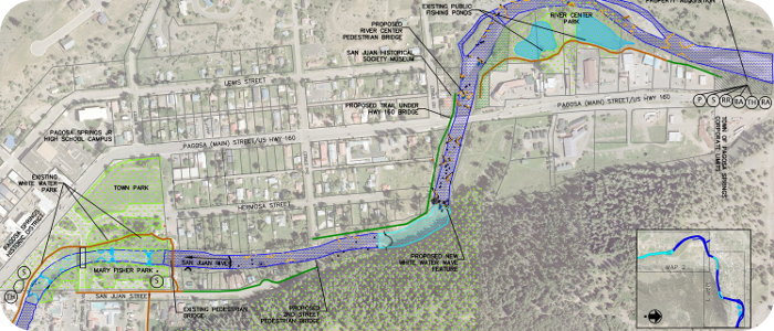
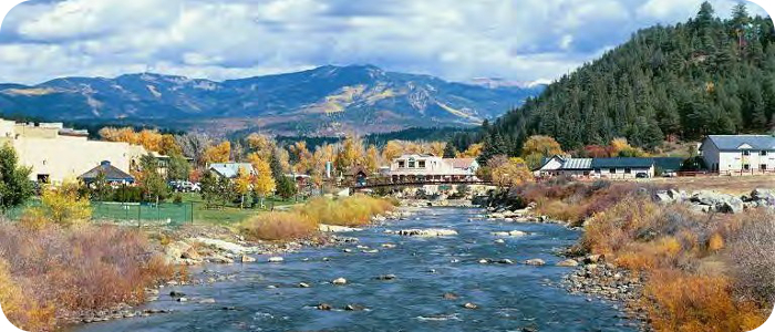
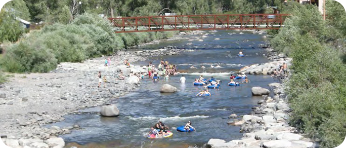
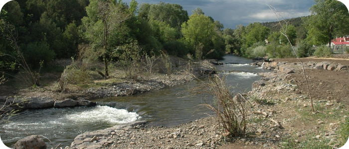
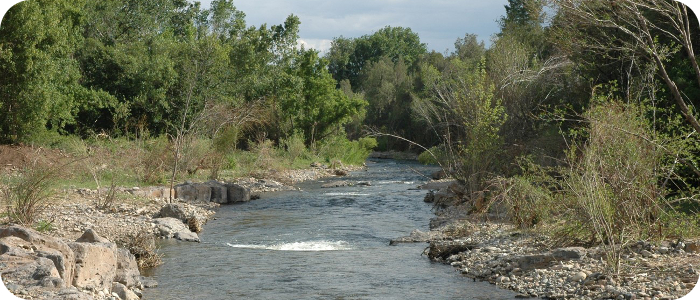
San Juan River in Pagosa Springs, CO
The San Juan River Improvement project included master planning, design, and construction oversight. Improvements included five whitewater waves (with fish passage), two boat ramps, three irrigation diversions, many in-stream fish habitat structures, rehabilitation of two fishing ponds, pedestrian trail extension and connections to public restrooms and parking. The scope of work also includes floodplain analysis of several river sections in preparation for FEMA revisions, design and installation of a shallow groundwater pumping system for irrigation supply, many public meetings and Town Council presentations, grant writing and grant application presentations, and other related consulting.

Related News
8 Feb 2018
Pagosa Sun “Town approves construction of seventh whitewater feature”
“On Jan. 18, the Pagosa Springs Town Council unanimously voted to engage Wolf Creek Ski Area and Riverbend Engineering to complete a seventh whitewater feature on the San Juan River.…”
20 Feb 2014
 Pagosa Sun “White Water”
“The white water river feature behind Town Hall receives a little touch-up work Tuesday morning before crews move down to a spot in the San Juan near Yamaguchi Park where they began building the fifth such structure. Chris Pitcher from Riverbend Engineering designed the features and supervises the work while his uncle, Davey Pitcher from Wolf Creek Ski Area, donates the equipment and labor. …”
3 June 2010
Pagosa Sun “Council considers additional river whitewater features”
“On Tuesday, the Pagosa Springs Town Council heard a recommendation from the town’s Parks and Recreation Department to expand whitewater features in the San Juan river through town from four to nine. …”
26 March 2009
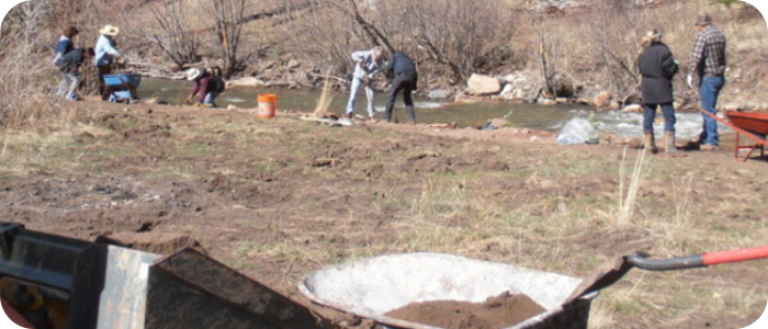
Pagosa Sun “Volunteers, donations help with whitewater project”
“A wonderful transformation has occurred in downtown Pagosa Springs over the last couple of weeks, and it’s time to officially thank the various talented individuals and generous citizens who made our new river improvement project such an apparent success.
Through the efforts of these folks a new whitewater feature, as yet unnamed, has been created, and fish habitat and fisherman’s access have been enhanced.
Riverbend Engineering of Pagosa Springs, represented by Chris Philips, Chris Pitcher and Brad Meyer, did the design work, set up the necessary meetings with the various stakeholders, coordinated the construction, and oversaw two weeks of intensive work. Their professionalism and thoroughness made a complex process as smooth and natural as the flow of snow-melt over the new drop. …”
3 Oct 2008
Pagosa Sun “New life for river project”
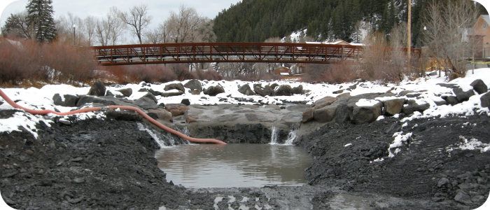
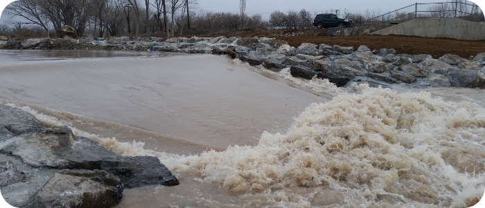
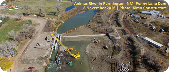
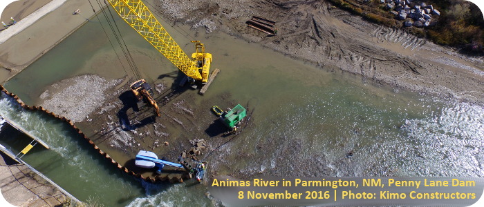
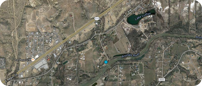
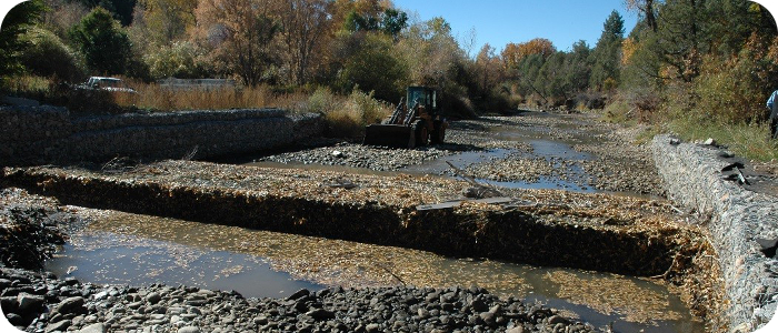
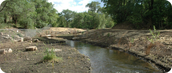
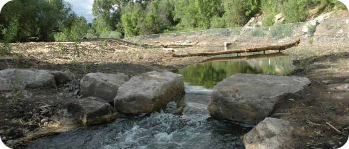
Animas River Penny Lane Dam in Farmington, NM
![]()
Riverbend prepared a Feasibility Analysis Report for Low Head Dam Modifications to the Animas Pump Station Diversion on the Animas River at Penny Lane Dam in August of 2013. This low head dam was constructed in 1984 to allow for diversion of water from the Animas River for the public water supply of the City of Farmington. Water taken out of the river is pumped up to Lake Farmington, a raw water storage facility located on a hilltop to the north.
Since its construction the dam and diversion facilities had met the project goals for water diversion, but had created the un-intended consequence of preventing fish passage and the un-desirable effect of dangerous hydraulic conditions for boats to float through (resulting in two deaths, in 2005 and 2011).
Riverbend conducted a feasibility study which included design alternatives to improve fish passage conditions, and to improve boater safety conditions, as well as building a whitewater wave feature at this location. Final design and environmental documentation were completed in 2015, and construction took place October 2016 – January 2017. Now on the Animas River fish can travel up and downstream, and the new waves provide two options (two degrees of difficulty) for fun and safe boating from the way from Colorado/ New Mexico state line all the way to Kirtland.
Related News:
15 March 2017
Farmington Daily Times “City officials raft over Penny Lane Dam”
15 March 2017
KOB News 4 Coverage of the newly modified Penny Lane Dam/ Whitewater Park in Farmington, NM
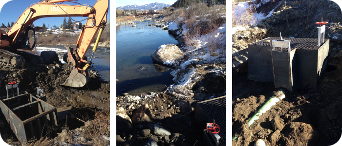
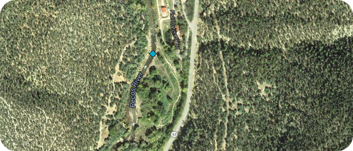
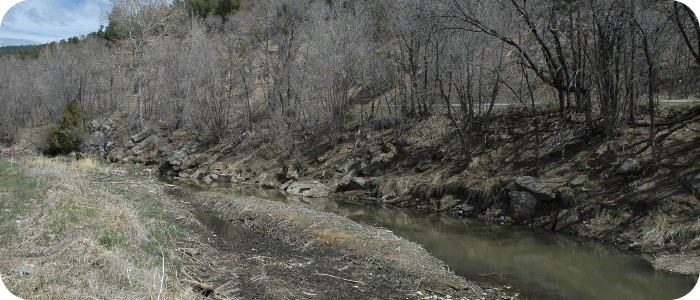
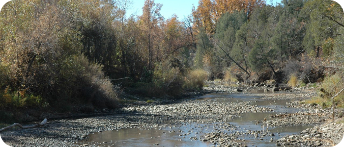
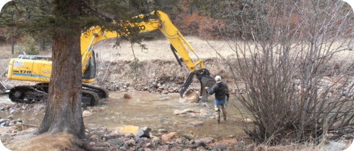
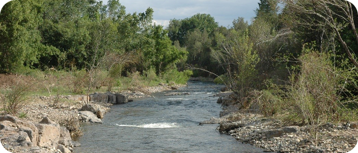
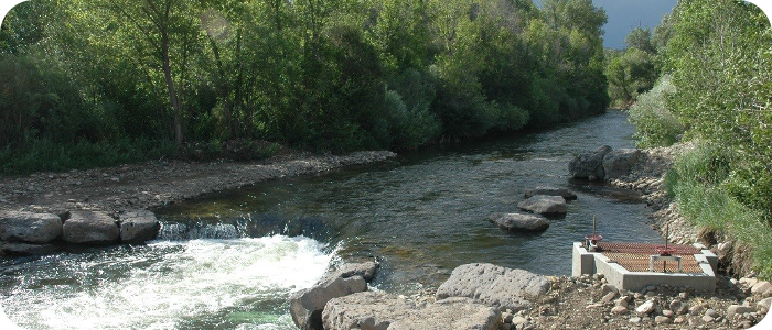
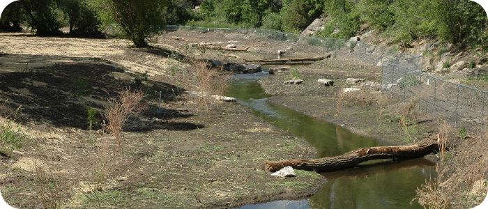
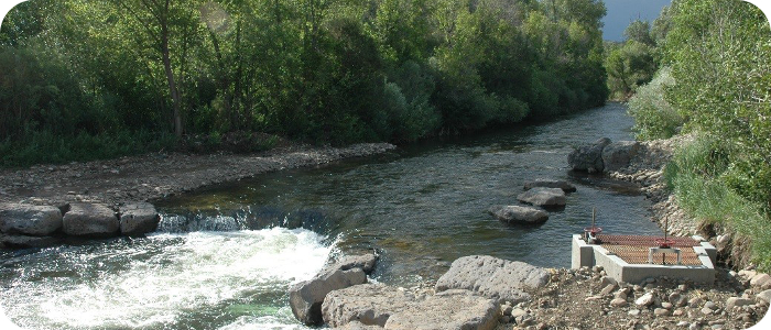
Pecos River near Pecos, NM – UPWA Hatchistery
![]() Construction of several dams for an irrigation diversion had raised the water level by 8 ft, creating a sediment trap and a fish barrier. Riverbend Engineering conducted topographic and stream morphology surveys for the Upper Pecos Watershed Association (UPWA), and proposed a design for the active river channel that would be morphologically stable. The irrigation diversion intake was relocated upstream, reconstructed with large boulders and a sediment sluice was added to the headbox. A series of smaller grade control structures allow for a flatter overall river profile, restoring fish passage and improving sediment transport continuity.
Construction of several dams for an irrigation diversion had raised the water level by 8 ft, creating a sediment trap and a fish barrier. Riverbend Engineering conducted topographic and stream morphology surveys for the Upper Pecos Watershed Association (UPWA), and proposed a design for the active river channel that would be morphologically stable. The irrigation diversion intake was relocated upstream, reconstructed with large boulders and a sediment sluice was added to the headbox. A series of smaller grade control structures allow for a flatter overall river profile, restoring fish passage and improving sediment transport continuity.
Read about Upper Pecos Watershed Association UPWA web site.
Article in The Santa Fe New Mexican 7-14-2014
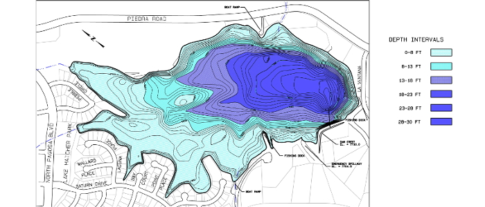
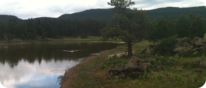
Lakes near Pagosa Springs, CO
Riverbend Engineering completed bathymetric surveys of four lakes in the Pagosa Springs area for the local water utility authority. The surveys were completed using sonar depth measurements and simultaneous total station measurements of the survey boat’s location. Bathymetric mapping was developed from the survey point data and the resulting 3D ground surface model. Stage-Volume relationships were developed for each reservoir, and were used by the client to verify their storage capacity relative to their deeded water rights.
The 4 lakes are Hatcher Lake (fed by a diversion from Martinez Creek), Lake Pagosa (fed by a diversion from Stevens Creek), Village Lake (just downstream of Lake Pagosa), and Lake Forest (just downstream of Village Lake)–click on the lake names (above) for their topo maps.

La Canada Dam near Angelfire, NM
Riverbend prepared an assessment report for the current condition of this dam. Riverbend’s work included: a limited topographic mapping effort to measure the size and shape of the embankment; inspection of active seepage areas, an assessment of the hazard classification of the dam, hydrologic calculations to determine the inflow design flood for the emergency spillway, prepare concept plans and cost estimates for potential rehabilitation projects.
Hidden Lake near Chama, NM
Riverbend Engineering completed a bathymetric survey of this high elevation lake. A Stage-Volume relationship was developed for the lake. Riverbend analyzed the hydrologic response of the watershed and calculated peak rates of runoff that would be expected in a 100-y event. Riverbend evaluated the hydraulic capacity of the existing spillway system, and made recommendations on how the capacity of the emergency spillway could be increased to meet current NM OSE standards.
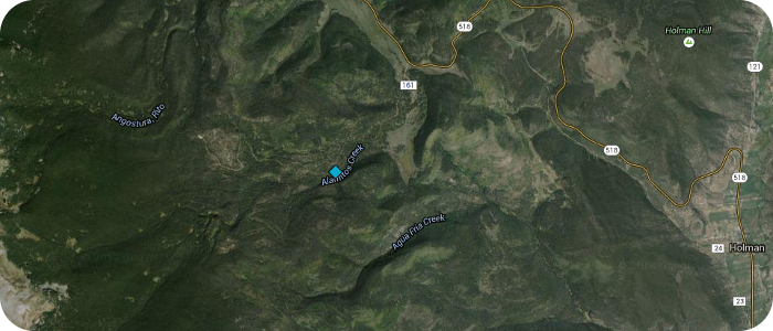
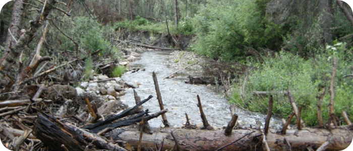
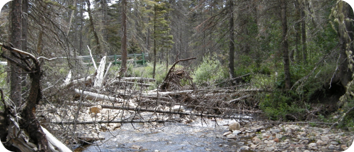
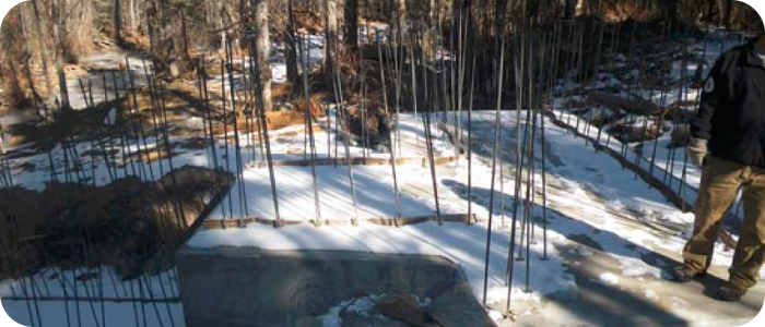
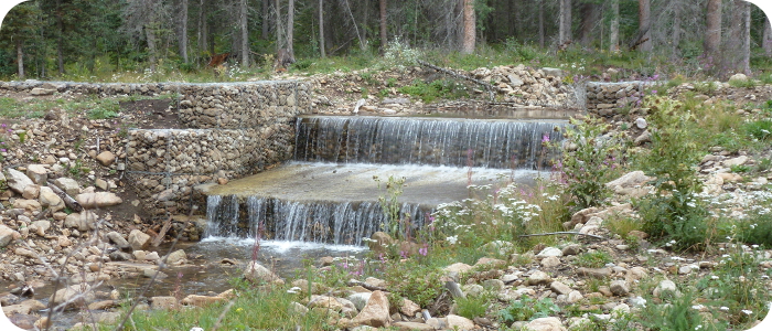
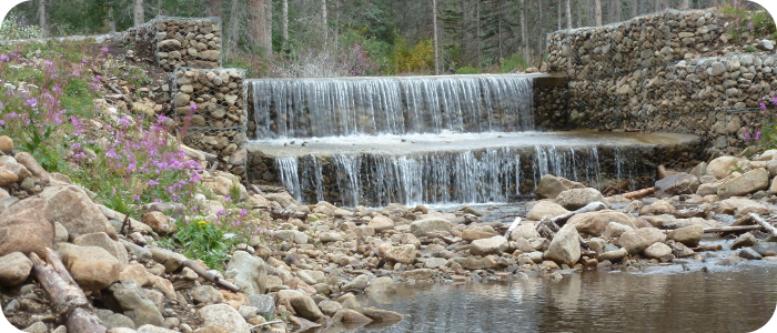
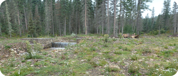
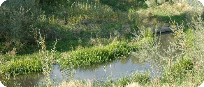
Alamitos Creek near Moro, NM

![]() Trout Unlimited (TU) was the project sponsor for design and construction of a fish barrier on Alamitos Creek in the Rio Pueblo drainage east of Sipapu. TU had identified a small population of pure Rio Grande cutthroat trout in this perennial stream. These fish had been protected from upstream migration of other salmonids by an old irrigation diversion structure, until a flood event destroyed that diversion structure. TU worked with the USFS and the local irrigation district to plan for a new fish barrier that would keep this native fish population isolated. To accomplish this project, TU’s national office and the Truchas TU Chapter obtained a Western Native Trout Initiative (WNTI) grant to construct the new fish barrier protecting of 7.5 stream miles. U.S. Forest Service personnel completed NEPA documentation and Riverbend provided engineering design and construction oversight for the project. Alamitos was a fast track project where stakeholders met in the Spring, environmental impact documentation was accomplished in the Summer and barrier construction was completed just before the onset of Winter. This project satisfied the WNTI Joint Venture’s goal of building, funding, and implementing collaborative conservation efforts.
Trout Unlimited (TU) was the project sponsor for design and construction of a fish barrier on Alamitos Creek in the Rio Pueblo drainage east of Sipapu. TU had identified a small population of pure Rio Grande cutthroat trout in this perennial stream. These fish had been protected from upstream migration of other salmonids by an old irrigation diversion structure, until a flood event destroyed that diversion structure. TU worked with the USFS and the local irrigation district to plan for a new fish barrier that would keep this native fish population isolated. To accomplish this project, TU’s national office and the Truchas TU Chapter obtained a Western Native Trout Initiative (WNTI) grant to construct the new fish barrier protecting of 7.5 stream miles. U.S. Forest Service personnel completed NEPA documentation and Riverbend provided engineering design and construction oversight for the project. Alamitos was a fast track project where stakeholders met in the Spring, environmental impact documentation was accomplished in the Summer and barrier construction was completed just before the onset of Winter. This project satisfied the WNTI Joint Venture’s goal of building, funding, and implementing collaborative conservation efforts.
Read more on the New Mexico Council for Trout Unllmited web site: newmexicotu.org and the Western Native Trout Initiative web site: westernnativetrout.org