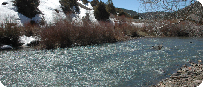
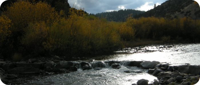
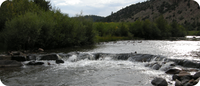
 Some Riverbend clients want to maximize the sport fishery on their property, and other clients are more concerned about mitigating a disturbance and overall ecological health. No matter what the primary goal of the project is, the foundation for success in aquatic and riparian restoration work is a functioning river system. This means transporting pulses of sediment, accommodating overbank floods, sustaining vigorous populations of fish, aquatic insects, and riparian vegetation. Riverbend’s designs allow the river to regain the equilibrium conditions that were lost, and we try to do this with the least amount of obvious man-made structure, leaving behind naturally aesthetic and functioning systems. We have worked on rivers small and large (by southwestern U.S. standards). We identify the underlying cause(s) of degradation, and develop and implement construction plans to bring the river back to a healthy, self-sustaining condition. Scroll below or use the menu to the right to read more about our river restoration and fish habitat projects.
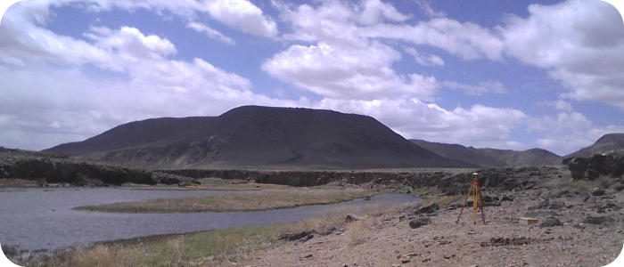
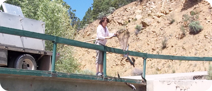
Red River in Questa, NM -- NMDGF
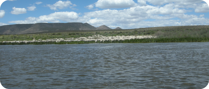
Eagle Rock Lake & Red River Hatchery
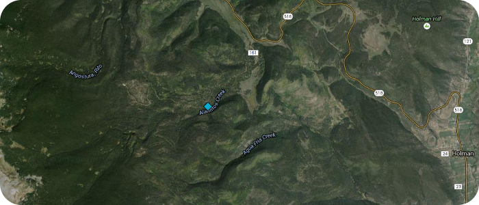
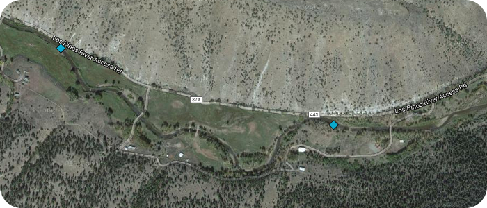
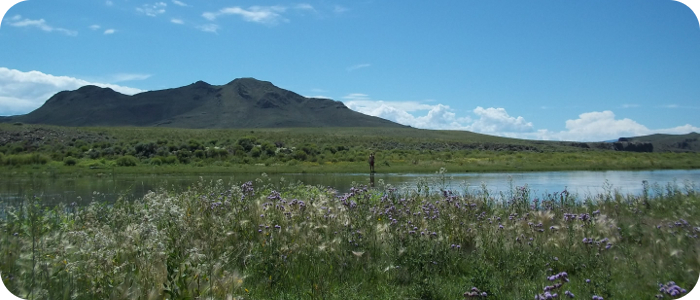
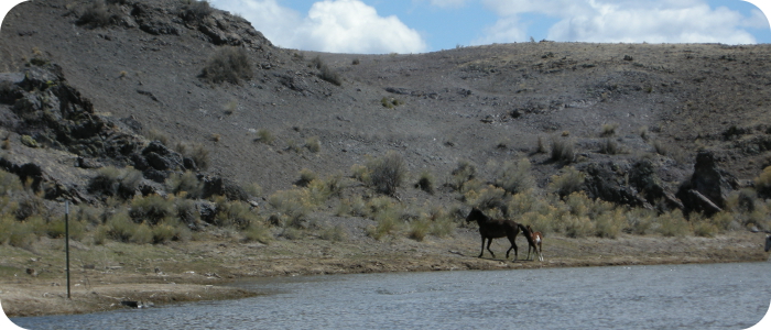
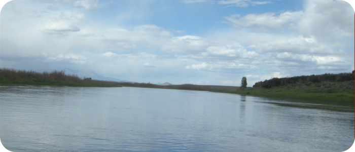
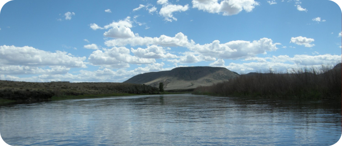
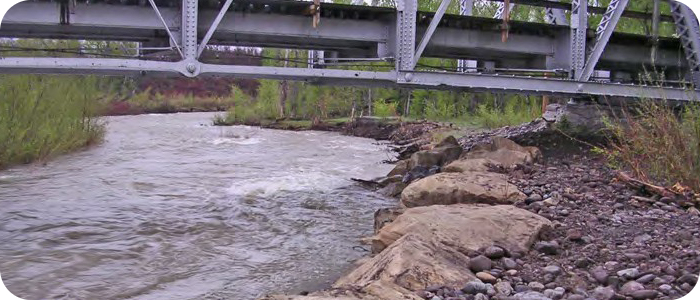
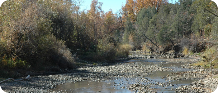
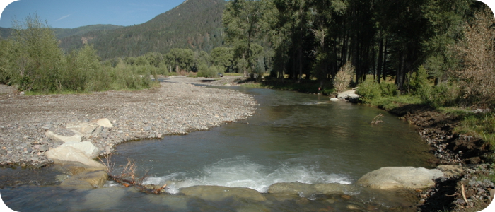
Navajo River near Dulce, NM--Jicarilla Apache Game & Fish

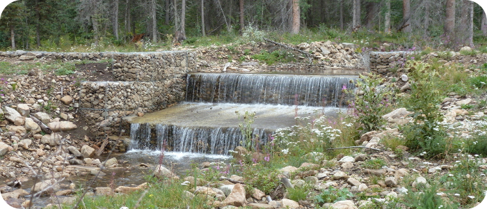
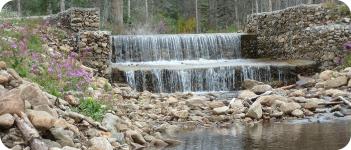
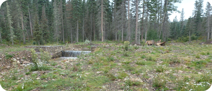
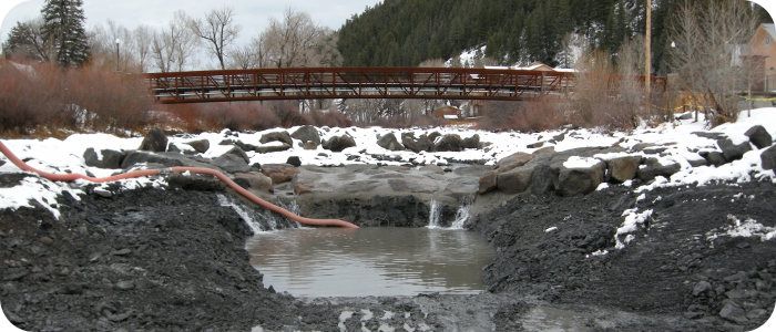
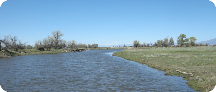
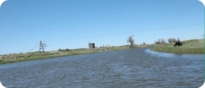
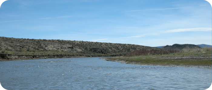
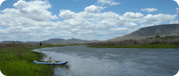
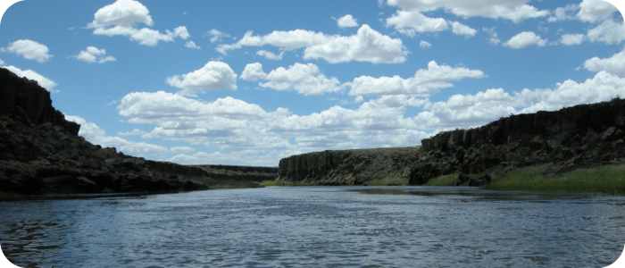
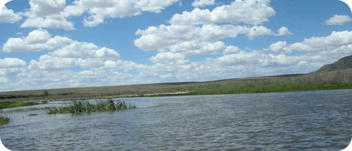
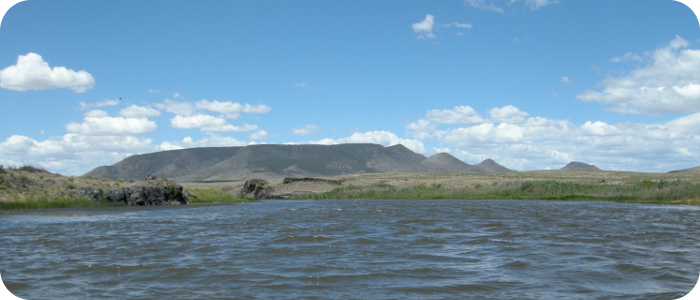
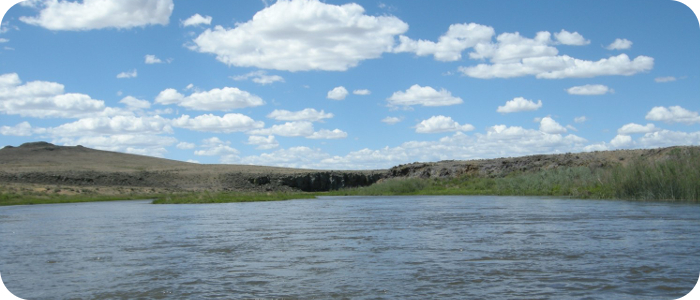
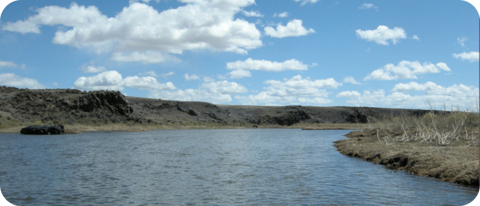
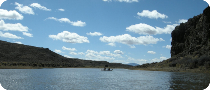
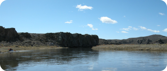
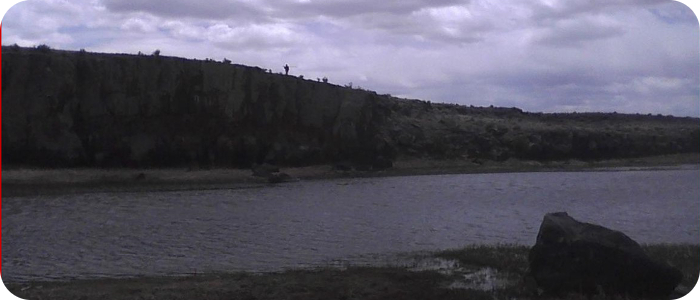
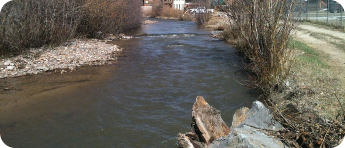
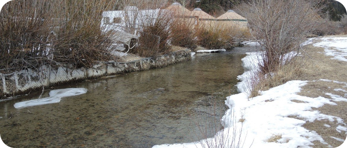
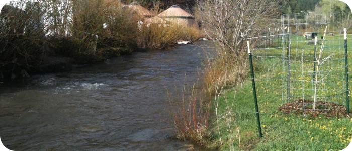
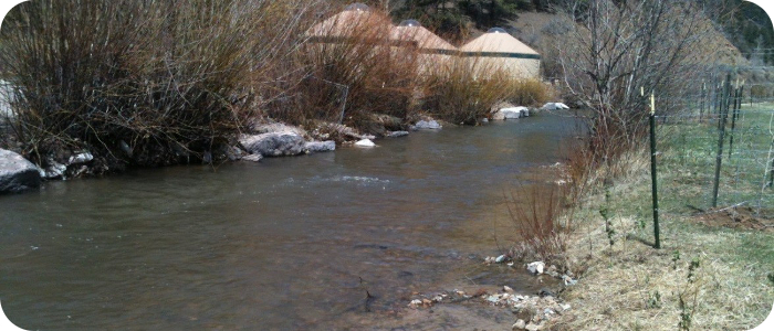
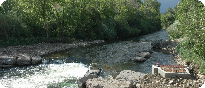
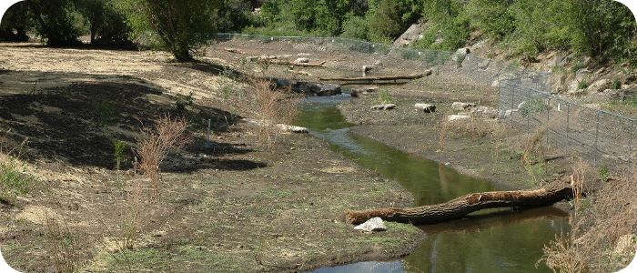
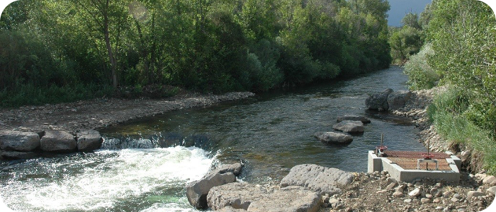
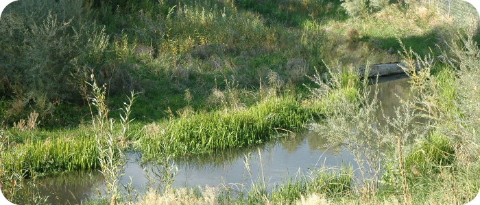
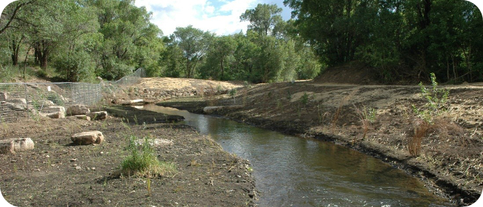
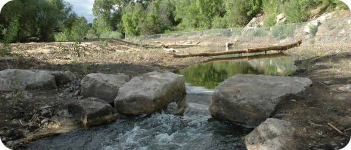
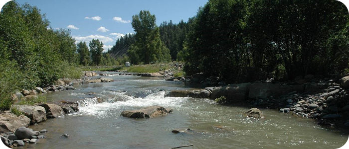
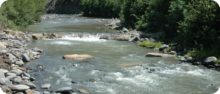
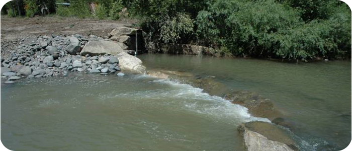
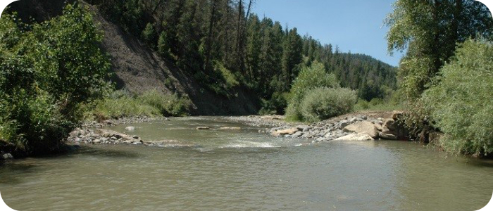
 Endangered Fish Habitat & Municipal Water Supply Diversion
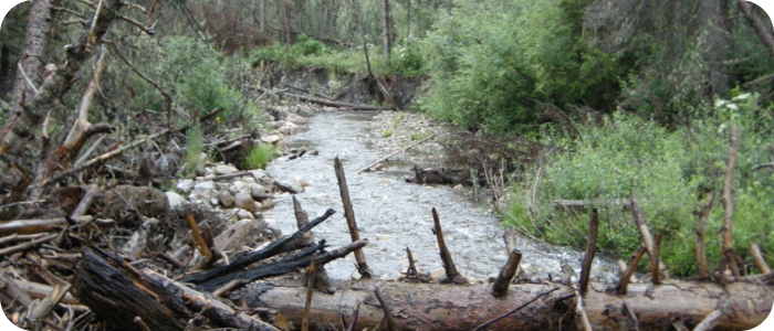
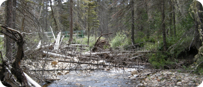
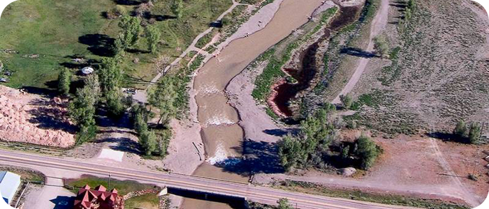
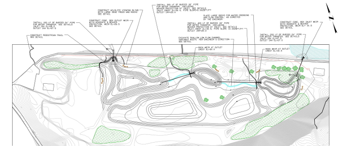
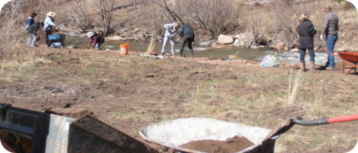
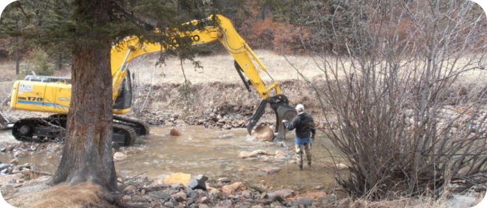
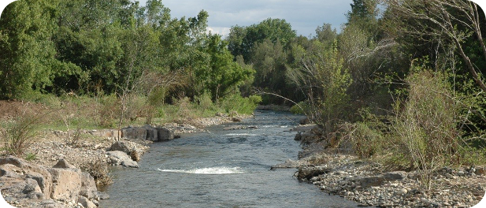
This project spanned over 4 years and included a river assessment of ~9 miles for possible fish habitat improvements for species of concern, Roundtail chub (Gila robusta) on the Navajo River above Dulce, NM. That assessment has led so far to ~5 miles of river restoration projects, and reconstruction of the main diversion dam for the potable water supply for the town.
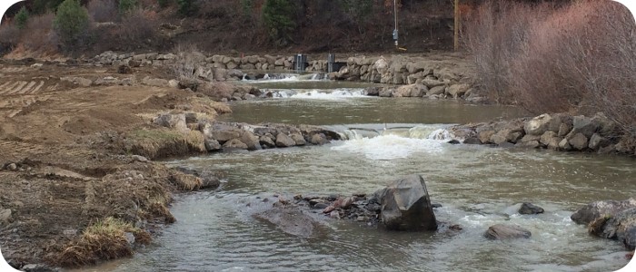
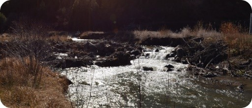
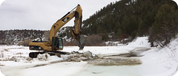
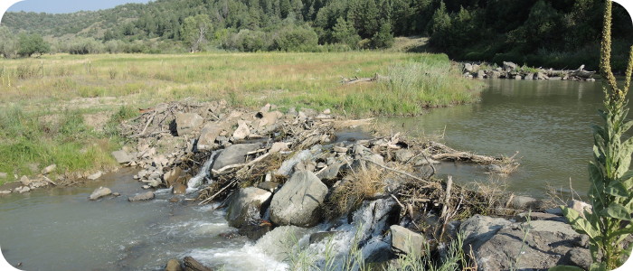
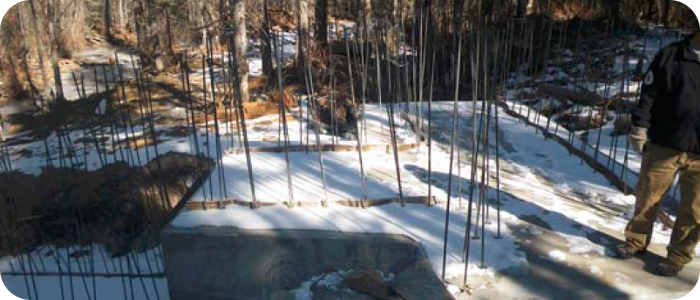
To ensure an adequate diversion of water for the community, the existing dam (piled up river gravel and large rocks) required annual maintenance efforts. The old dam also created a fish passage barrier, impeding the Nation’s efforts at recovery of the Chub. The Nation initially considered a much more expensive concept plan for a concrete structure. In the end the diversion was constructed with large boulders and a series of step-pool weirs extending downstream. Native riparian transplants ensured high function and aesthetics as well as reduced annual maintenance costs. This alternative design provides for natural fish passage and minimizes maintenance time and costs significantly.
Riverbend’s services to the Nation included surveying, hydrologic and hydraulic calculations, preliminary and final designs, construction cost estimates, confirmation of 404 & 401 permit exemptions, project specifications and bid documents. In the implementation phase of the irrigation dam modification project Riverbend was hired as the general contractor, and had construction management personnel onsite each day during construction.
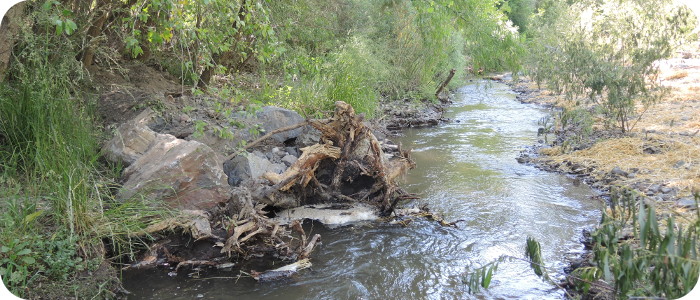
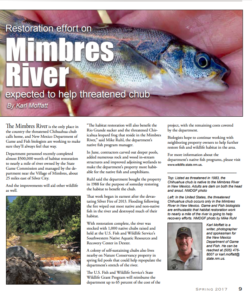
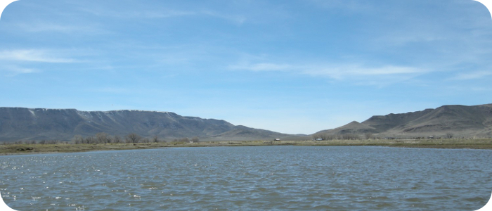
Rio Mimbres in Mimbres, NM - NMDGF
 River Restoration for Endangered Species
PHASE I: Mimbres Wildlife Area
This mile-long section of the Rio Mimbres has been owned by the New Mexico Department of Game & Fish (NMDGF) for several decades. This reach is managed for conservation of the endangered Chihuahua Chub fish (Gila nigrescens) and the listed Chiricahua leopard frog (Lithobates chiricahuensis)–public access is limited and fishing is not allowed. A forest fire in 2006 in the Black Range had left the upper reaches of the Rio Mimbres watershed devastated. Subsequently there have been several very large flow events that originated on burn-scar areas. Sediment deposition and woody debris accumulations from these fire accentuated runoff events had made habitat conditions that were already poor even worse. The river restoration design for this project paid special attention to the specific habitat needs of both endangered species, and preserved the status of the very healthy existing riparian vegetation.
PHASE II: Mimbres River Preserve, The Nature Conservancy
(more information coming soon)
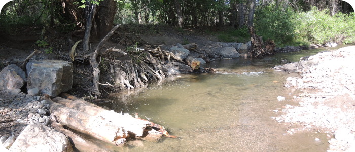
Riverbend’s services to NMDGF for both these projects included surveying, hydrologic and hydraulic calculations, preliminary and final designs, construction cost estimates, project specifications, and bid documents. In the implementation phase of the project Riverbend provided construction oversight. To mimic natural habitat features where sustainable populations of the Chub are currently found, design relied heavily on woody debris type structures and localized scour pools. Habitat for the frog was created by enhancing natural wetland depressions, and with new off channel ponds that are hydraulically connected to the river.
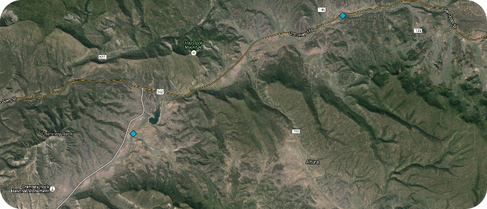
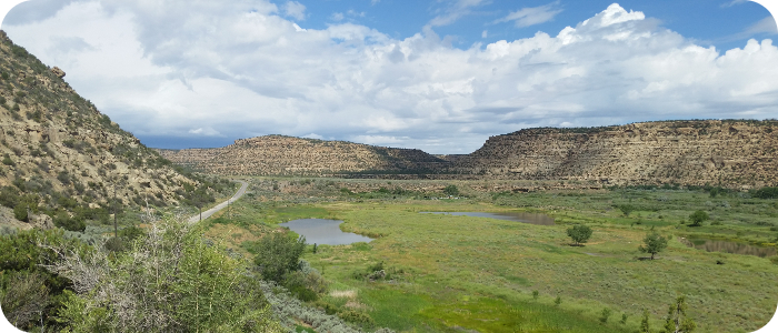
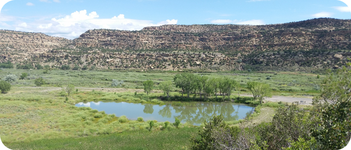
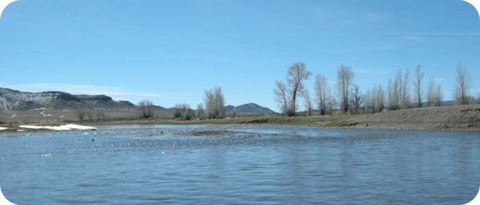
Stollsteimer Creek near Chimney Rock, CO
 Channel incision and bank erosion had led to poor water quality conditions and a lack of riparian vegetation. This valley area on the Southern Ute Tribe provides winter habitat for elk and a perennial water source for many mammals. The design solution included grading of point bars and low floodplains where feasible, preventing bank erosion with toe rock and construction of a floodplain bench behind the rock. Riverbend’s geomorphic analysis aided in the design of a low flow system inset within a larger channel & floodplain form capable of passing the 5 year event.
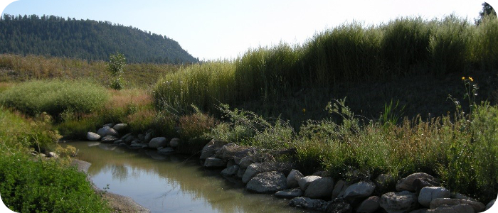
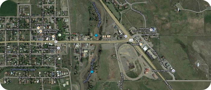
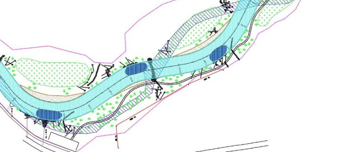
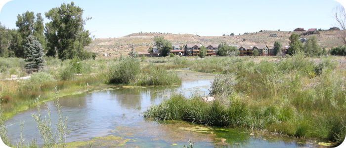
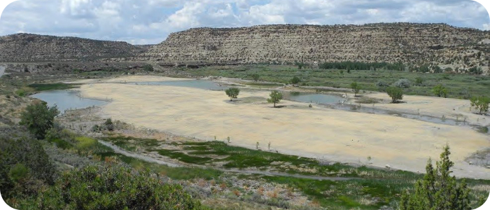
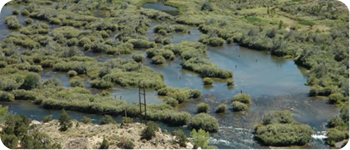
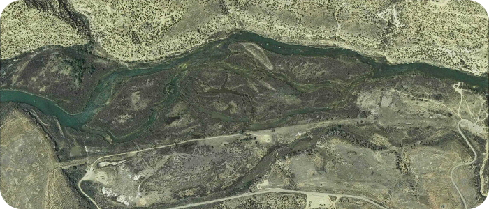
Uncompahgre River in Ridgway, CO
![]() This project included complete river restoration, addressing decades of in-stream gravel mining. Restoration work included grading of a stable single thread channel, bank stabilization with large woody debris and large boulders, grade control and fish habitat structures, construction of multiple wetlands (open water and shallow depression types), and construction of two whitewater wave features. A new pedestrian trail was designed, extending from an existing Town park all the way north through the restored river section. The restoration work terminates at the north end at an historic railroad bridge. The design had to accommodate a new pedestrian bridge, an existing CDOT bridge, an existing sanitary sewer crossing the river, fish passage throughout, nesting bald eagle habitat, and a very high sediment load from the upstream watershed. Analysis and documentation of changes to the regulatory floodplain were prepared for FEMA map revisions. Aerial photo “Before” shows highly braided river system after in-stream gravel mining in the 1970s through 1990s. Low angle aerial image “After” shows the restored river with open water wetlands in right foreground, depression wetlands (dark brown areas) further downriver, a CDOT bridge and two whitewater wave features in the foreground. Bald eagle habitat is protected on river-right in the downstream (background) part of the project.
This project included complete river restoration, addressing decades of in-stream gravel mining. Restoration work included grading of a stable single thread channel, bank stabilization with large woody debris and large boulders, grade control and fish habitat structures, construction of multiple wetlands (open water and shallow depression types), and construction of two whitewater wave features. A new pedestrian trail was designed, extending from an existing Town park all the way north through the restored river section. The restoration work terminates at the north end at an historic railroad bridge. The design had to accommodate a new pedestrian bridge, an existing CDOT bridge, an existing sanitary sewer crossing the river, fish passage throughout, nesting bald eagle habitat, and a very high sediment load from the upstream watershed. Analysis and documentation of changes to the regulatory floodplain were prepared for FEMA map revisions. Aerial photo “Before” shows highly braided river system after in-stream gravel mining in the 1970s through 1990s. Low angle aerial image “After” shows the restored river with open water wetlands in right foreground, depression wetlands (dark brown areas) further downriver, a CDOT bridge and two whitewater wave features in the foreground. Bald eagle habitat is protected on river-right in the downstream (background) part of the project.
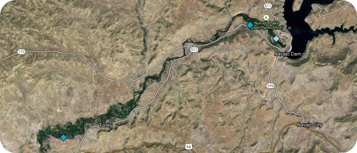
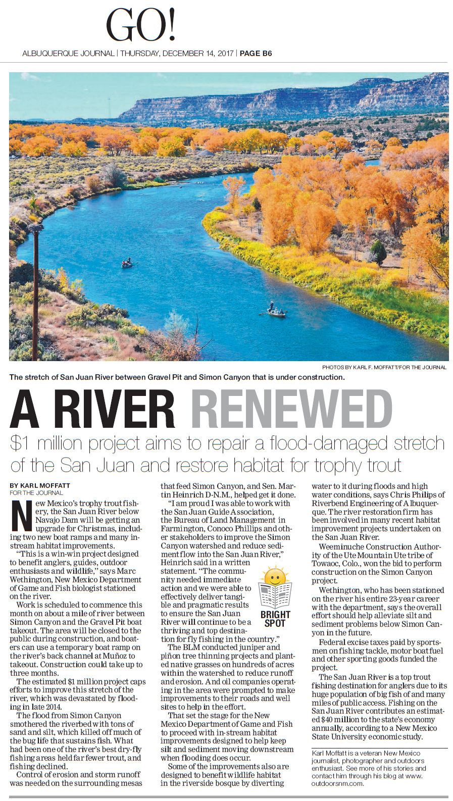
San Juan River below Navajo Dam, NM - NMDGF Quality Waters
![]() Riverbend Engineering has been working with the New Mexico Department of Game & Fish on its river restoration efforts as outlined in the Management plan for the San Juan River published in September of 2005. This reach of Quality Trout Waters is below Navajo Dam on the San Juan River in northern New Mexico east of Aztec & Bloomfield, NM. Projects include the Braids, Munoz Flats, Hammond Tract, Simon Canyon, and the Rainbow Lodge Boat Ramp.
Riverbend Engineering has been working with the New Mexico Department of Game & Fish on its river restoration efforts as outlined in the Management plan for the San Juan River published in September of 2005. This reach of Quality Trout Waters is below Navajo Dam on the San Juan River in northern New Mexico east of Aztec & Bloomfield, NM. Projects include the Braids, Munoz Flats, Hammond Tract, Simon Canyon, and the Rainbow Lodge Boat Ramp.
RELATED NEWS:
December 2017 | ABQ JOURNAL & OUTDOORS NM
 “A River Renewed”
… about Simon Canyon & Rainbow Lodge.
Winter 2014 | NMDGF Wildlife
“Wetlands Project Improves Habitat for Fish, Wildlife, Anglers”
…about Munoz Flats.
Fall 2014 | NMDGF Wildlife
“Anglers, Hunters Get More Access to San Juan River”
… about Hammond Tract.
July 2014 | ABQ Journal & Outdoors NM
“Angling or Solitude?” / “Brand New Aquatic Park on the San Juan River at Hammond Tract”
… about Hammond Tract.
March 2014 | Outdoors NM
“San Juan River Taking on a Whole New Look”
… about the Braids
Spring/ Summer 2012 | NMDGF Wildlife
“San Juan River Habitat Projects Brings New Life”
… about the Braids
June 2012 | Outdoors NM
“Habitat Improvements on New Mexico’s San Juan River a Huge Success”
… a summary of projects to date.
December 2011 | NMDGF Press Release
“San Juan River Habitat Work Opens More Trophy Trout Fishing”
… about the Braids.
November 2011 | Outdoors NM
“Latest San Juan Project to Limit Silt, Improve Fishing”
… about the Braids.
December 2007 | Outdoors NM
“NM News – San Juan Improvement Project Complete”
… about Phase III – below Cottonwood Campground.
June 2007 | Outdoors NM
“The San Juan River – Habitat Improvement Project”
… about Phase II – below Simon Canyon.
[OTHER NEWS STORIES ABOUT RIVERBEND ENGINEERING & OUR RIVER RESTORATION PROJECTS]
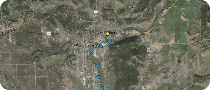
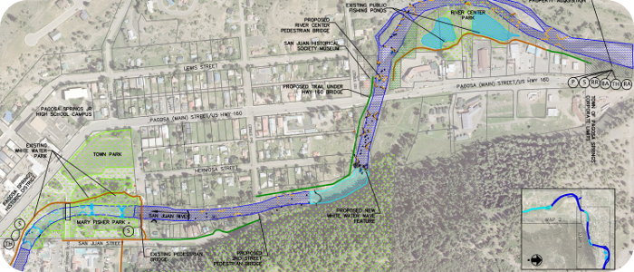
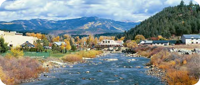
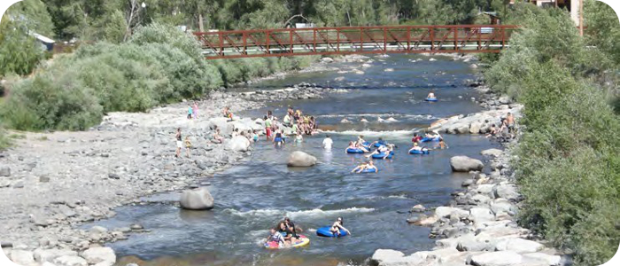
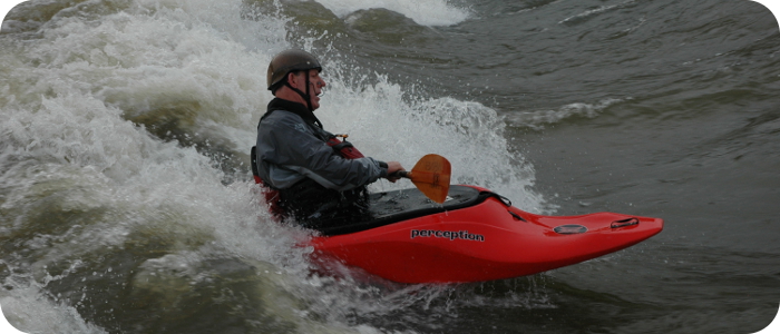
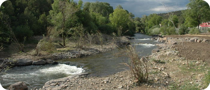
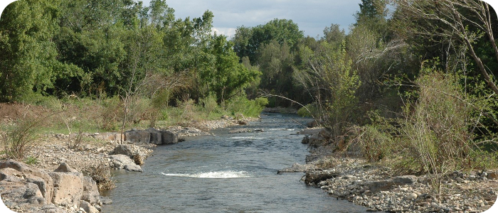
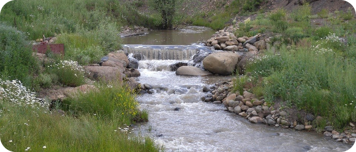
San Juan River in Pagosa Springs, CO
The San Juan River Improvement project included master planning, design, and construction oversight. Improvements included five whitewater waves (with fish passage), two boat ramps, three irrigation diversions, many in-stream fish habitat structures, rehabilitation of two fishing ponds, pedestrian trail extension and connections to public restrooms and parking. The scope of work also includes floodplain analysis of several river sections in preparation for FEMA revisions, design and installation of a shallow groundwater pumping system for irrigation supply, many public meetings and Town Council presentations, grant writing and grant application presentations, and other related consulting.

Related News
8 Feb 2018
Pagosa Sun “Town approves construction of seventh whitewater feature”
“On Jan. 18, the Pagosa Springs Town Council unanimously voted to engage Wolf Creek Ski Area and Riverbend Engineering to complete a seventh whitewater feature on the San Juan River.…”
20 Feb 2014
 Pagosa Sun “White Water”
“The white water river feature behind Town Hall receives a little touch-up work Tuesday morning before crews move down to a spot in the San Juan near Yamaguchi Park where they began building the fifth such structure. Chris Pitcher from Riverbend Engineering designed the features and supervises the work while his uncle, Davey Pitcher from Wolf Creek Ski Area, donates the equipment and labor. …”
3 June 2010
Pagosa Sun “Council considers additional river whitewater features”
“On Tuesday, the Pagosa Springs Town Council heard a recommendation from the town’s Parks and Recreation Department to expand whitewater features in the San Juan river through town from four to nine. …”
26 March 2009
Pagosa Sun “Volunteers, donations help with whitewater project”
“A wonderful transformation has occurred in downtown Pagosa Springs over the last couple of weeks, and it’s time to officially thank the various talented individuals and generous citizens who made our new river improvement project such an apparent success.
Through the efforts of these folks a new whitewater feature, as yet unnamed, has been created, and fish habitat and fisherman’s access have been enhanced.
Riverbend Engineering of Pagosa Springs, represented by Chris Philips, Chris Pitcher and Brad Meyer, did the design work, set up the necessary meetings with the various stakeholders, coordinated the construction, and oversaw two weeks of intensive work. Their professionalism and thoroughness made a complex process as smooth and natural as the flow of snow-melt over the new drop. …”
3 Oct 2008
Pagosa Sun “New life for river project”
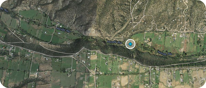
Rio Hondo near Arroyo Seco, NM – Valdez Ranch
Riparian zone grazing has led to unstable river banks and an over-wide channel bottom. Fish habitat potential was very limited. The landowner had already stopped grazing the riparian area, but the river had not regained much fish holding capacity. The design solution involved rock and wood structure in the river, shaping of pools and side bars, willow transplants, and maintaining as much existing vegetation as possible.
Rio de los Pinos south of Ortiz, CO – SMEG
This is a project of the San Miguel Ecological Group (SMEG) and is located upstream from the gauge at Ortiz, CO the Rio de los Pinos flows south into NM towards Chama. Historic overgrazing had led to poor riparian vegetation and an over-wide river channel. Riverbend Engineering’s design narrowed up the active channel, decreased the width to depth ratio, increased pool depth and increased in-stream fish habitat structure. The fish holding capacity has increased significantly.
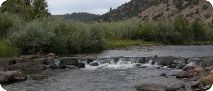
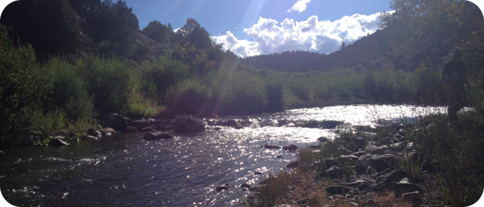

Rio Grande near Alamosa, CO - RGHRP
DOWNLOAD FINAL REPORT
![]() The Rio Grande Headwaters Restoration Project and its outgrowth, the Colorado Rio Grande Restoration Foundation is interested in finding ways to improve the historical functions of the headwaters of the Rio Grande in Colorado. A river condition assessment was completed in 2001 of the first 91 miles (from the upstream town limits of South Fork to the Alamosa – Conejos County line) which resulted in a priority list of projects which are being done in phases. The first four phases have been completed, and more in planning and design phases. Also, Riverbend engineering has done a condition assessment study of the last ~35 miles from below the Alamosa Wildlife Refuge to the Colorado-New Mexico state line–download the 2016 final report here.
The Rio Grande Headwaters Restoration Project and its outgrowth, the Colorado Rio Grande Restoration Foundation is interested in finding ways to improve the historical functions of the headwaters of the Rio Grande in Colorado. A river condition assessment was completed in 2001 of the first 91 miles (from the upstream town limits of South Fork to the Alamosa – Conejos County line) which resulted in a priority list of projects which are being done in phases. The first four phases have been completed, and more in planning and design phases. Also, Riverbend engineering has done a condition assessment study of the last ~35 miles from below the Alamosa Wildlife Refuge to the Colorado-New Mexico state line–download the 2016 final report here.
In the top study area (91 miles) The characteristics of the river are similar in all locations: low gradient, fine grained sediments, active bank erosion and limited woody riparian vegetation. And so, the restoration goals are similar at all of the sites: reduce bank erosion and improve riparian vegetation. By doing so, the health of the river is improved with better shade, reduced water temperatures, improved depth, better continuity of sediment movement and improved riparian habitat. The approach is to 1) flatten the river’s radius of curvature where the curvature gets too small; 2) install rock structures (rock deflectors) on the outside of the re-aligned bends that will resist lateral channel migration and reduce shear stress in the near bank region; and 3) encourage the establishment of a dense riparian vegetation colony on a new floodplain bench on the outside of these same meander bends, so that the vegetation can control the long-term bank stability and rate of erosion/lateral channel migration.

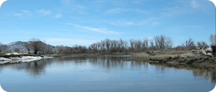
Rio Chama near Chama, NM – Cumbres & Toltec
![]() The scope of work addressed stabilization of an eroding riverbank, threatening the south abutment of an historic railroad bridge. Riverbend designed the bank stabilization with large boulders. Riverbend handled the 404 and 401 permitting for the Cumbres & Toltec Railroad, and Riverbend directed the installation of the bank stabilization measures. Riverbend has also worked with the Cumbres & Toltec Railroad on the design of new railroad track at the Chama Depot, including rail extensions across the state highway.
The scope of work addressed stabilization of an eroding riverbank, threatening the south abutment of an historic railroad bridge. Riverbend designed the bank stabilization with large boulders. Riverbend handled the 404 and 401 permitting for the Cumbres & Toltec Railroad, and Riverbend directed the installation of the bank stabilization measures. Riverbend has also worked with the Cumbres & Toltec Railroad on the design of new railroad track at the Chama Depot, including rail extensions across the state highway.
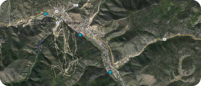
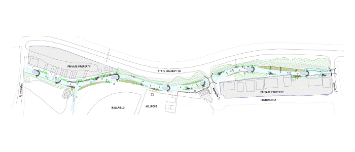
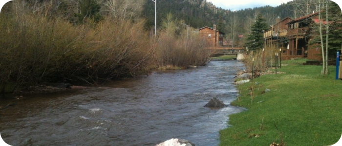
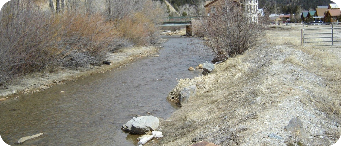
Red River in Red River, NM
 The Town of Red River, NM has a long history of enjoying the river as it runs right through town. The Town identified 3 Phases of restoration work and has since completed 2/3 of the stretch.
Phase 1, “Young’s Ranch Reach” runs through the east edge of town and was a priority due to heavy damage from flooding in the spring of 2005, which resulted in considerable bank erosion and soil loss. Sediment from the flooding also caused impacts to downstream water quality. Several homes had become threatened by stream bank erosion, and public utilities had been damaged by the flood. In 2006, the Town completed its first river restoration project on the east end of town. A combination of bank stabilization treatments, riparian transplants, and in-stream aquatic habitat structures were installed to repair the existing flood damage, mitigate against future flood damage and water quality impacts, and improve the natural habitat within the project area.
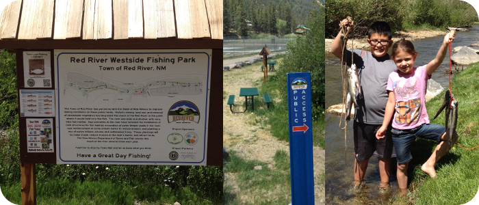
Phase 2, “Red River Westside Fishing Park”, runs through the west edge of Town and was completed on a very fast time-line. Approval of the funding was officially announced on January 10, 2014, and construction was completed before the end of April, allowing time for stocking and plentiful fishing for the Memorial Day holiday. Historic mining, land use and removal of streamside vegetation had degraded this reach of the Red River to the point where it would hold very few fish. The river was wide and shallow, with very little fish habitat. Improvements to the river have included the installation of various rock structures for fish habitat, excavation of some deeper pools in the river, rock reinforcement of some stream banks to reduce erosion, and planting a mix of native willow and shrub species, and cottonwood trees. These plantings will increase shade, reduce erosion of the river’s banks, and attract birds. The New Mexico Department of Game and Fish stocks this reach of the river several times each year.
Phase 3, “Town Reach Restoration Project” runs through the middle of downtown Red River and is funded by the State of New Mexico Environment Department’s River Stewardship Program Grant. This project was completed in October of 2016.
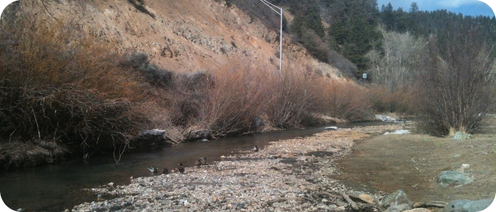
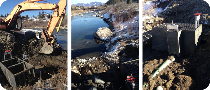
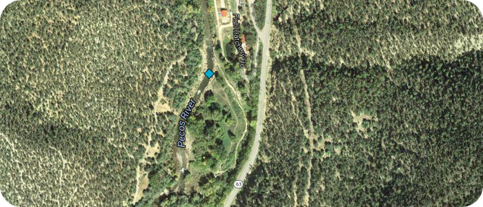
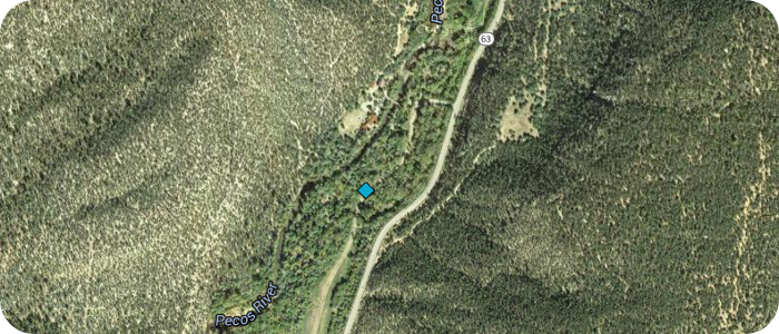
Pecos River near Pecos, NM – UPWA Hatchistery
![]() Construction of several dams for an irrigation diversion had raised the water level by 8 ft, creating a sediment trap and a fish barrier. Riverbend Engineering conducted topographic and stream morphology surveys for the Upper Pecos Watershed Association (UPWA), and proposed a design for the active river channel that would be morphologically stable. The irrigation diversion intake was relocated upstream, reconstructed with large boulders and a sediment sluice was added to the headbox. A series of smaller grade control structures allow for a flatter overall river profile, restoring fish passage and improving sediment transport continuity.
Construction of several dams for an irrigation diversion had raised the water level by 8 ft, creating a sediment trap and a fish barrier. Riverbend Engineering conducted topographic and stream morphology surveys for the Upper Pecos Watershed Association (UPWA), and proposed a design for the active river channel that would be morphologically stable. The irrigation diversion intake was relocated upstream, reconstructed with large boulders and a sediment sluice was added to the headbox. A series of smaller grade control structures allow for a flatter overall river profile, restoring fish passage and improving sediment transport continuity.
Read about Upper Pecos Watershed Association UPWA web site.
Article in The Santa Fe New Mexican 7-14-2014
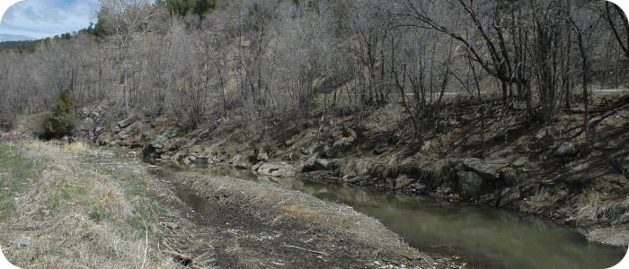
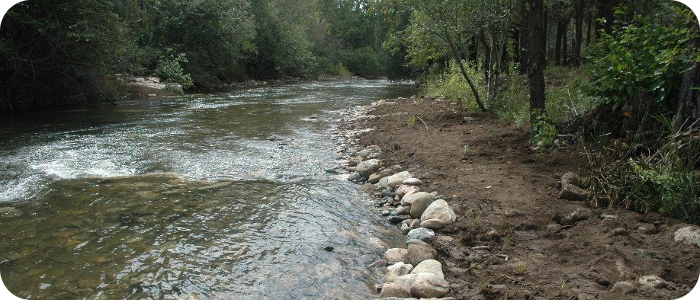
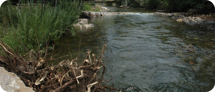
Pecos River near Pecos, NM – Kooi
Historic degradation and widening of the river had created shallow flow conditions and limited aquatic habitat for salmonids. Riverbend’s geomorphic analysis documented relatively recent channel bed lowering and straightening of the channel plan form as a result of the incised conditions. The design solution included narrowing the low flow channel of the river, excavating deep pools, adding rock structures and woody debris structures for fish habitat, grading of alternating gravel bars along the active channel, planting of obligate wetland species and riparian adapted native ornamental shrubs to create a parallel riverine wetland.
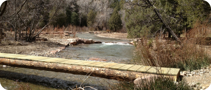
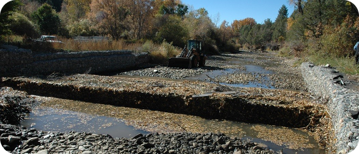
Pecos River near Pecos, NM – Casdagli
This project restored a section of the river, which was severely damaged by flooding in September, 2013. The project included full replacement of an existing irrigation diversion dam and headbox, installation of in-stream fish habitat structures, restoration of a river side channel as spawning habitat, installation of riparian and wetland plant species.
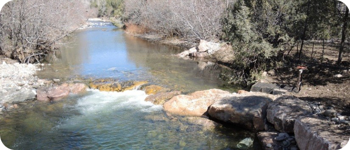
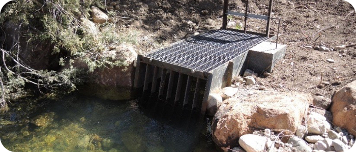
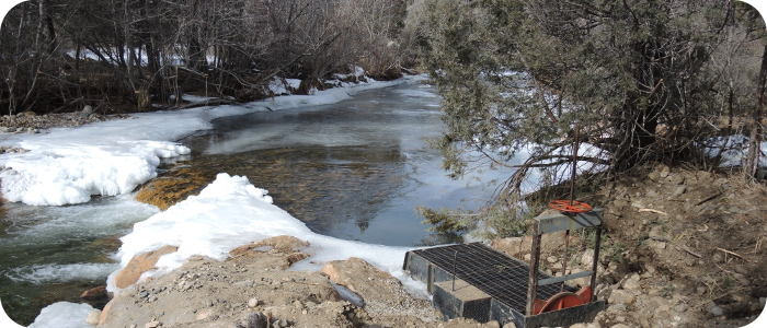
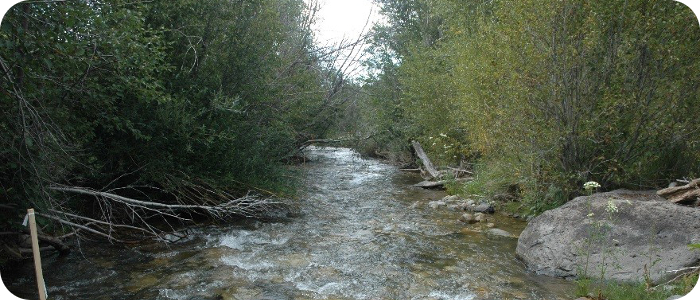
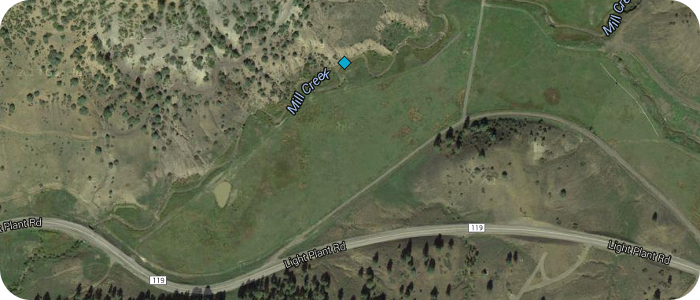
Mill Creek near Pagosa Springs, CO – Levine
Channel degradation and bank erosion from over-grazing and poor management of irrigation water had led to poor water quality conditions and a lack of riparian vegetation. Riverbend Engineering’s design provided a “two-tiered” channel and floodplain system, where typical irrigation driven low flows would sustain a smaller channel and floodplain inset into a larger channel and floodplain system. Riverbend’s design solution included narrowing and re- shaping of the active channel, grading of point bars and low floodplain areas, preventing bank erosion with rock piles and willow transplants. Grazing limitations were placed on the riparian zone, and new irrigation ditches were cut to better manage their water resources.
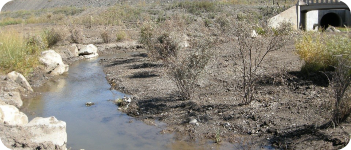
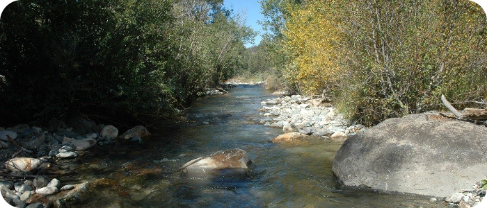
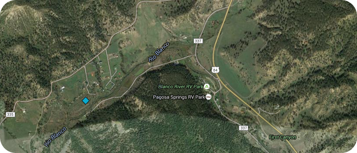
Lower Blanco River near Pagosa Springs, CO – LBPOA
In the early 1970s a water diversion was constructed as part of the Colorado River Compact. This diversion takes water from the Blanco and the Navajo Rivers, and transfers that water to the Rio Grande watershed. The Blanco River below the diversion has seen a very limited quantity of water each year since the diversion was constructed. Riverbend’s goals for this project are to improve conditions in the river, making the best use of the remaining water in the channel. Riverbend’s design provided for a narrower channel to convey flows, as well as pool complexes to provide cooling. Restoration of this stretch of the Rio Blanco River was the Colorado Department of Public Health and Environment’s first CWA section 319-funded project aimed at addressing hydrologic modifications. In the last 15 years over 12-miles have been restored so the stream channel now matches the altered flow regime, and the landowners have been educated.
Related News
Pagosa Sun
15 June 2011
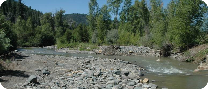
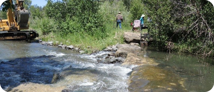
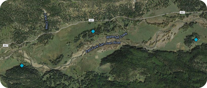
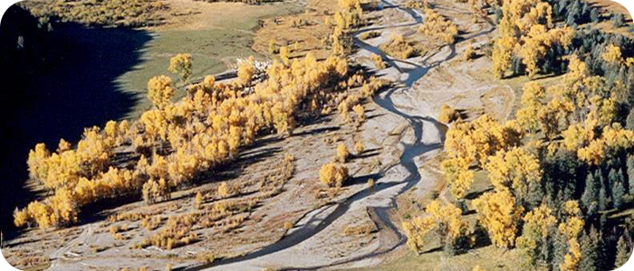
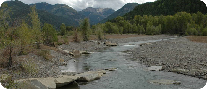
East Fork San Juan River near Pagosa Springs, CO – East Fork Ranch
Wholesale removal of riparian vegetation by mechanical means in the 1930s left this 3.5 mile stretch of the upper San Juan River in an unstable condition. Decades later, the river had not achieved any stability, and emergent riparian vegetation was not able to establish. The client’s vision included full restoration of a single thread channel, an active floodplain, riffle/ pool structure in the river, and re-establishment of a wide riparian vegetation corridor. Riverbend designed a stream restoration to meet this vision. The River channel has been re-shaped to re-establish an appropriate meander pattern. Rock structures provide bank stability and encourage pool formation. Riparian vegetation transplant work has continued for several years. “Before” photo shows the unstable, braided river system; and the “After” photos shows how the river channel has been re-shaped to re-establish an appropriate meander pattern. Rock structures provide bank stability and encourage pool formation. Riparian vegetation transplant work has continued for several years.
Alamitos Creek near Moro, NM

![]() Trout Unlimited (TU) was the project sponsor for design and construction of a fish barrier on Alamitos Creek in the Rio Pueblo drainage east of Sipapu. TU had identified a small population of pure Rio Grande cutthroat trout in this perennial stream. These fish had been protected from upstream migration of other salmonids by an old irrigation diversion structure, until a flood event destroyed that diversion structure. TU worked with the USFS and the local irrigation district to plan for a new fish barrier that would keep this native fish population isolated. To accomplish this project, TU’s national office and the Truchas TU Chapter obtained a Western Native Trout Initiative (WNTI) grant to construct the new fish barrier protecting of 7.5 stream miles. U.S. Forest Service personnel completed NEPA documentation and Riverbend provided engineering design and construction oversight for the project. Alamitos was a fast track project where stakeholders met in the Spring, environmental impact documentation was accomplished in the Summer and barrier construction was completed just before the onset of Winter. This project satisfied the WNTI Joint Venture’s goal of building, funding, and implementing collaborative conservation efforts.
Trout Unlimited (TU) was the project sponsor for design and construction of a fish barrier on Alamitos Creek in the Rio Pueblo drainage east of Sipapu. TU had identified a small population of pure Rio Grande cutthroat trout in this perennial stream. These fish had been protected from upstream migration of other salmonids by an old irrigation diversion structure, until a flood event destroyed that diversion structure. TU worked with the USFS and the local irrigation district to plan for a new fish barrier that would keep this native fish population isolated. To accomplish this project, TU’s national office and the Truchas TU Chapter obtained a Western Native Trout Initiative (WNTI) grant to construct the new fish barrier protecting of 7.5 stream miles. U.S. Forest Service personnel completed NEPA documentation and Riverbend provided engineering design and construction oversight for the project. Alamitos was a fast track project where stakeholders met in the Spring, environmental impact documentation was accomplished in the Summer and barrier construction was completed just before the onset of Winter. This project satisfied the WNTI Joint Venture’s goal of building, funding, and implementing collaborative conservation efforts.
Read more on the New Mexico Council for Trout Unllmited web site: newmexicotu.org and the Western Native Trout Initiative web site: westernnativetrout.org