 Riverbend has advised many clients on the regulatory limitations imposed on their land by local and Federal floodplain management rules. When a FEMA map shows a floodplain on a particular property, that property owner needs to know what limits may be imposed on them when they want to develop or improve their property. Riverbend has issued simple Elevation Certificates for new construction, all the way to detailed hydraulic flood studies that result in a formal FEMA map change. We know the regulations, and our two Certified Floodplain Managers attend floodplain conferences and training sessions so that we can stay well informed. Scroll below or use the menu to the right to read more about the flood studies we have done in regulatory FEMA flood zones.
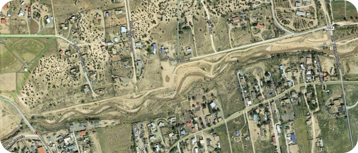
Santa Fe River near Santa Fe, NM--Santa Fe County
![]()
Riverbend has worked with Santa Fe County since 2011. Our first project with the County included design, permitting and construction management of wetland improvements, trail and parking access improvements at Arroyo Hondo Open Space. Between 2012 and 2014 Riverbend worked on the design and construction oversight of three separate river restoration projects in the Santa Fe River. On several of these projects Riverbend was a design sub-consultant to a larger firm, but on the most recent flood damage repair project Riverbend was the prime contractor with the County. Through these multiple projects Riverbend has established a strong working relationship with County staff, even as other involved consultants have come and gone. This relationship and confidence in Riverbend’s technical abilities has led to Riverbend being selected for on-call services with the County, and the subsequent solicitation of cost proposals for engineering services at other locations within the County, see below.
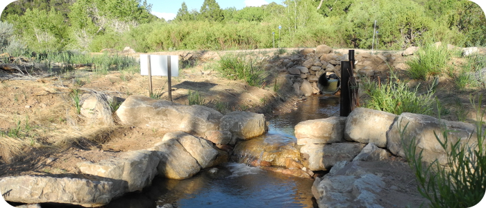
Santa Fe River Trail and Channel Improvements, Phase 4
Riverbend developed revised grade control structure concepts due to difficulties experienced during Phase 3 construction in obtaining adequate quantities of large boulders. Soil cement was ultimately decided upon.
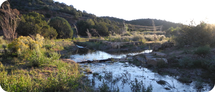
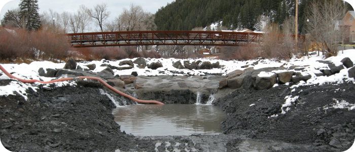
Santa Fe River Restoration at San Ysidro River Park in Agua Fria, NM
Riverbend Engineering was hired as a river expert for this river restoration and stormwater management project. Approximately two years after the initial prototype restoration work was completed along the Santa Fe River between the San Ysidro crossing and Caja del Oro Grant Road, an estimated 100-year storm caused damage to several sections of the newly reconstructed riverbed. To address those areas, Riverbend designed repairs and/or modifications to some of the previous work, plus new improvements including additional grade control structures, bank erosion protection structures, riparian plantings, and additional stormwater rundowns at the river. Following completion of the design, Santa Fe County hired Riverbend directly to oversee construction of the repair work in this section of the river. Due to their river expertise and success on this and other similar projects, Riverbend is now included on the County’s list of pre-qualified consultants.
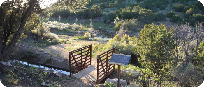
Santa Fe River at the Randall Davey Audubon Center
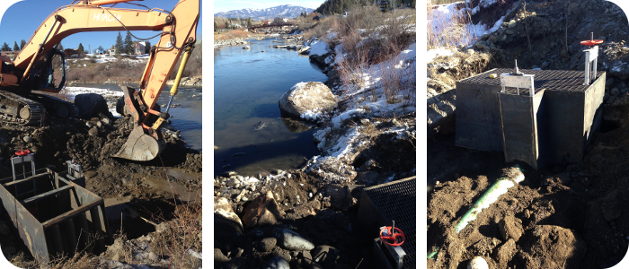
Riverbend Engineering provided technical expertise for river restoration design in the upper reaches of the Santa Fe River adjacent to the Audubon Center. The riparian vegetation enhancement project extended from the old Two-Mile Dam site to the Acequia Madre headgate, and included mapping, inventory and designation of surviving riparian habitat, as well as restoration of degraded areas. Riverbend developed the primary designs for both the river restoration work and a flow diversion structure that was included in the final plan set. Riverbend also provided construction phase support.
Arroyo Hondo Open Space
Our first project with the County included design, permitting and construction management of wetland improvements, trail and parking access improvements at Arroyo Hondo Open Space.
Frenchies Field & Siler Road
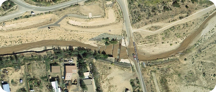
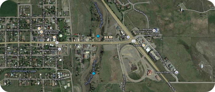
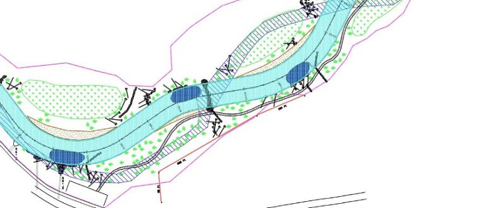
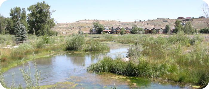
Uncompahgre River in Ridgway, CO
![]() This project included complete river restoration, addressing decades of in-stream gravel mining. Restoration work included grading of a stable single thread channel, bank stabilization with large woody debris and large boulders, grade control and fish habitat structures, construction of multiple wetlands (open water and shallow depression types), and construction of two whitewater wave features. A new pedestrian trail was designed, extending from an existing Town park all the way north through the restored river section. The restoration work terminates at the north end at an historic railroad bridge. The design had to accommodate a new pedestrian bridge, an existing CDOT bridge, an existing sanitary sewer crossing the river, fish passage throughout, nesting bald eagle habitat, and a very high sediment load from the upstream watershed. Analysis and documentation of changes to the regulatory floodplain were prepared for FEMA map revisions. Aerial photo “Before” shows highly braided river system after in-stream gravel mining in the 1970s through 1990s. Low angle aerial image “After” shows the restored river with open water wetlands in right foreground, depression wetlands (dark brown areas) further downriver, a CDOT bridge and two whitewater wave features in the foreground. Bald eagle habitat is protected on river-right in the downstream (background) part of the project.
This project included complete river restoration, addressing decades of in-stream gravel mining. Restoration work included grading of a stable single thread channel, bank stabilization with large woody debris and large boulders, grade control and fish habitat structures, construction of multiple wetlands (open water and shallow depression types), and construction of two whitewater wave features. A new pedestrian trail was designed, extending from an existing Town park all the way north through the restored river section. The restoration work terminates at the north end at an historic railroad bridge. The design had to accommodate a new pedestrian bridge, an existing CDOT bridge, an existing sanitary sewer crossing the river, fish passage throughout, nesting bald eagle habitat, and a very high sediment load from the upstream watershed. Analysis and documentation of changes to the regulatory floodplain were prepared for FEMA map revisions. Aerial photo “Before” shows highly braided river system after in-stream gravel mining in the 1970s through 1990s. Low angle aerial image “After” shows the restored river with open water wetlands in right foreground, depression wetlands (dark brown areas) further downriver, a CDOT bridge and two whitewater wave features in the foreground. Bald eagle habitat is protected on river-right in the downstream (background) part of the project.
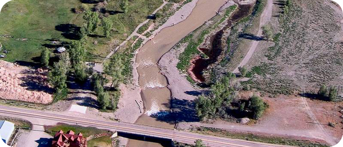
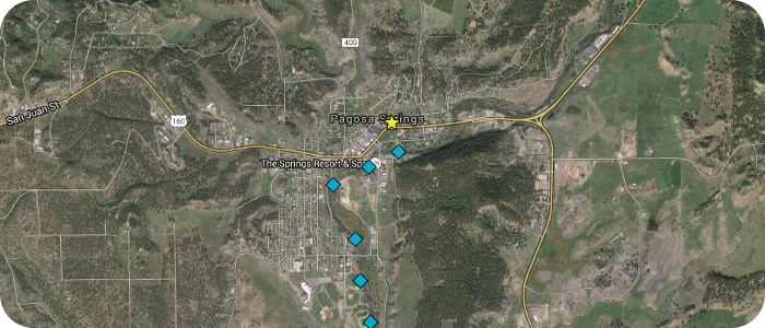
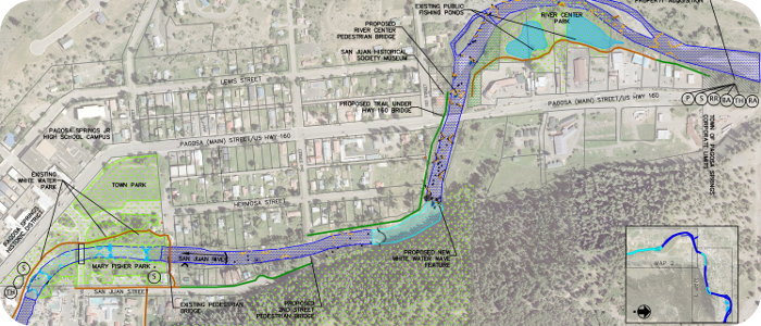
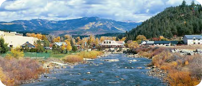
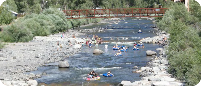
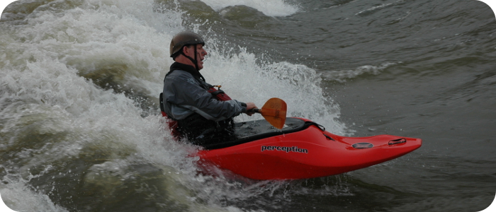
San Juan River in Pagosa Springs, CO
The San Juan River Improvement project included master planning, design, and construction oversight. Improvements included five whitewater waves (with fish passage), two boat ramps, three irrigation diversions, many in-stream fish habitat structures, rehabilitation of two fishing ponds, pedestrian trail extension and connections to public restrooms and parking. The scope of work also includes floodplain analysis of several river sections in preparation for FEMA revisions, design and installation of a shallow groundwater pumping system for irrigation supply, many public meetings and Town Council presentations, grant writing and grant application presentations, and other related consulting.

Related News
8 Feb 2018
Pagosa Sun “Town approves construction of seventh whitewater feature”
“On Jan. 18, the Pagosa Springs Town Council unanimously voted to engage Wolf Creek Ski Area and Riverbend Engineering to complete a seventh whitewater feature on the San Juan River.…”
20 Feb 2014
 Pagosa Sun “White Water”
“The white water river feature behind Town Hall receives a little touch-up work Tuesday morning before crews move down to a spot in the San Juan near Yamaguchi Park where they began building the fifth such structure. Chris Pitcher from Riverbend Engineering designed the features and supervises the work while his uncle, Davey Pitcher from Wolf Creek Ski Area, donates the equipment and labor. …”
3 June 2010
Pagosa Sun “Council considers additional river whitewater features”
“On Tuesday, the Pagosa Springs Town Council heard a recommendation from the town’s Parks and Recreation Department to expand whitewater features in the San Juan river through town from four to nine. …”
26 March 2009
Pagosa Sun “Volunteers, donations help with whitewater project”
“A wonderful transformation has occurred in downtown Pagosa Springs over the last couple of weeks, and it’s time to officially thank the various talented individuals and generous citizens who made our new river improvement project such an apparent success.
Through the efforts of these folks a new whitewater feature, as yet unnamed, has been created, and fish habitat and fisherman’s access have been enhanced.
Riverbend Engineering of Pagosa Springs, represented by Chris Philips, Chris Pitcher and Brad Meyer, did the design work, set up the necessary meetings with the various stakeholders, coordinated the construction, and oversaw two weeks of intensive work. Their professionalism and thoroughness made a complex process as smooth and natural as the flow of snow-melt over the new drop. …”
3 Oct 2008
Pagosa Sun “New life for river project”