Skip to content
Riverbend Engineering
Menu
  • Home
  • About
    • Our Approach & River Ethic
    • Our Equipment
    • Where We Work
    • Who We Work With
    • In the News
  • Portfolio
    • River Restoration & Fish Habitat
    • Wetlands & Ponds
    • Irrigation & Water Delivery Systems
    • River Condition Assessments
    • Flood Studies in Regulatory FEMA Flood Zones
    • Dams & Fish Barriers
    • Erosion Protection & Bridge Scour Studies
    • Whitewater Boating Parks
    • Stormwater Management Using Low Impact Developement
    • Recreation Site Improvements
  • Contact

Category: private landowner

private landowner / river restoration & fish habitat

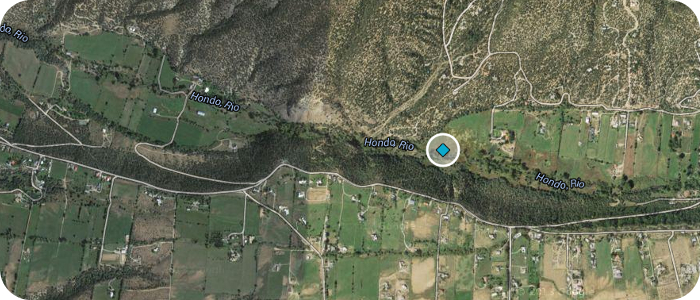
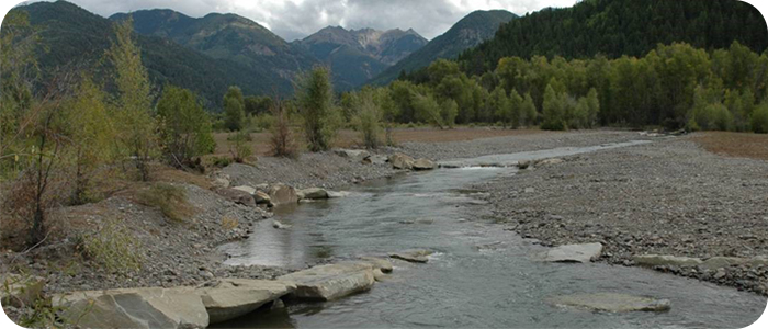
Rio Hondo near Arroyo Seco, NM – Valdez Ranch

Riparian zone grazing has led to unstable river banks and an over-wide channel bottom. Fish habitat potential was very limited. The landowner had already stopped grazing the riparian area, but …

irrigation diversions / private landowner / river restoration & fish habitat / wetlands & ponds

Pecos River near Pecos, NM – Kooi

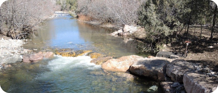
Historic degradation and widening of the river had created shallow flow conditions and limited aquatic habitat for salmonids. Riverbend’s geomorphic analysis documented relatively recent channel bed lowering and straightening of …

irrigation diversions / private landowner / river restoration & fish habitat / wetlands & ponds

Pecos River near Pecos, NM – Casdagli

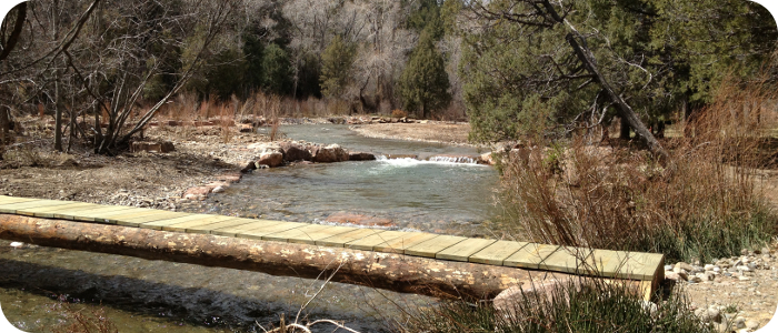
This project restored a section of the river, which was severely damaged by flooding in September, 2013. The project included full replacement of an existing irrigation diversion dam and headbox, …

irrigation diversions / private landowner / river restoration & fish habitat

Mill Creek near Pagosa Springs, CO – Levine

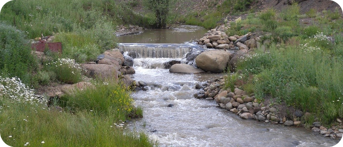
Channel degradation and bank erosion from over-grazing and poor management of irrigation water had led to poor water quality conditions and a lack of riparian vegetation. Riverbend Engineering’s design provided …

dams & fish barriers / private landowner

La Canada Dam near Angelfire, NM

Riverbend prepared an assessment report for the current condition of this dam. Riverbend’s work included: a limited topographic mapping effort to measure the size and shape of the embankment; inspection …

dams & fish barriers / private landowner

Hidden Lake near Chama, NM

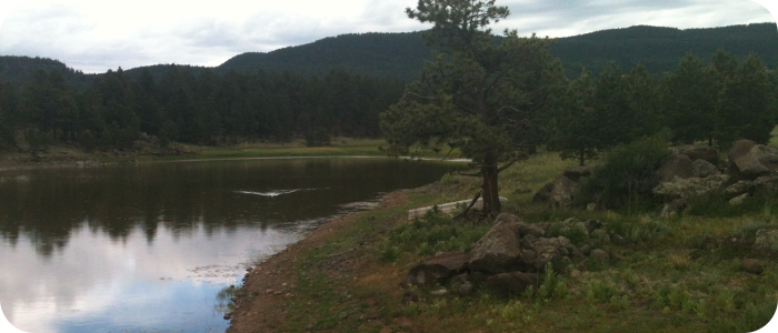
Riverbend Engineering completed a bathymetric survey of this high elevation lake. A Stage-Volume relationship was developed for the lake. Riverbend analyzed the hydrologic response of the watershed and calculated peak …

private landowner / river restoration & fish habitat

East Fork San Juan River near Pagosa Springs, CO – East Fork Ranch

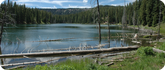
Wholesale removal of riparian vegetation by mechanical means in the 1930s left this 3.5 mile stretch of the upper San Juan River in an unstable condition. Decades later, the river …

PROJECT PORTFOLIO

  • River Restoration & Fish Habitat
  • Wetlands & Ponds
  • Irrigation & Water Delivery Systems
  • River Condition Assessments
  • Flood Studies in Regulatory FEMA Flood Zones
  • Dams & Fish Barriers
  • Erosion Protection & Bridge Scour Studies
  • Whitewater Boating Parks
  • Stormwater Management Using Low Impact Developement
  • Recreation Site Improvements

ABOUT RIVERBEND

About Riverbend Engineering

  • Our Approach & River Ethic
  • Our Equipment
  • Where We Work
  • Who We Work With
  • In the News

Project Portfolio

  • PORTFOLIO
  • River Restoration & Fish Habitat
  • Wetlands & Ponds
  • Irrigation & Water Delivery Systems
  • River Condition Assessments
  • Flood Studies in Regulatory FEMA Flood Zones
  • Dams & Fish Barriers
  • Erosion Protection & Bridge Scour Studies
  • Whitewater Boating Parks
  • Stormwater Management Using Low Impact Developement
  • Recreation Site Improvements

CONTACT US

NEW MEXICO:
505-344-3315
1309 Rio Grande Blvd. NW
Albuquerque, NM 87104

COLORADO:
970-264-1195
102 N. 3rd St. | POB 2979
Pagosa Springs, CO 81147

site map

Riverbend Engineering, LLC
© 1999-2020

Copyright © 2026 Riverbend Engineering – OnePress theme by FameThemes